Highly driven, full stack software developer with 11 years of experience architecting and developing against complex enterprise systems
Covid-19 Locations of Interest published by the NZ Govt
Used by over 100,000 Kiwis over the course of the pandemic
GithubThis simple application show a mobile friendly map of the locations of interest published by the NZ Govt during the pandemic. It evolved to provide automated to post location specific information to reddit via a node-RED automation
A cli tool for generating OpenSCAD 3d models from an .scad file and .toml config file
GithubGolang application for tracking players, roles, games and seasonal fines for a sports team
Github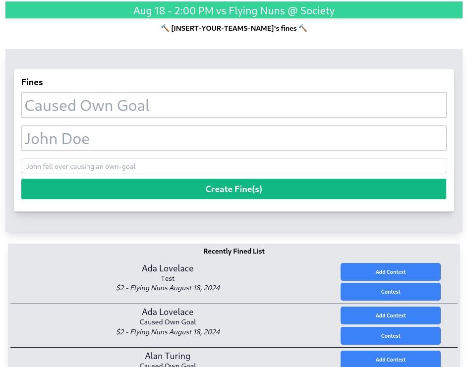
(wip) htmx extension that configures TomSelect Multi-select via simple html attributes
This is a simple htmx extension that allows you to configure TomSelect Multi-select via simple html attributes
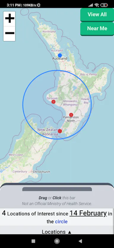
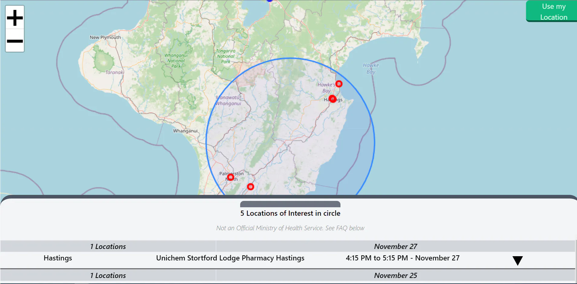
GithubDuring the pandemic, the New Zealand Ministry of Health published the locations of interest, but it wasn't mapped, searchable, sharable, or mobile-friendly (fair enough, they were busy!). I identified the need and published this app to provide a mobile-friendly view of these locations of interest.
To spread awareness, i extended the app to include a reddit bot that would post to relevant subreddits when a new location was added or updated.
With these efforts, the NZCovidMap reached over 200,000 Kiwis across New Zealand, with a peak of 15,000 daily unique visitors.
- - 4.5k users in the first month
- - 15k daily unique visitors
- - 200k total visitors
- - Circle-based location selection method
- A Mobile-friendly map view
- - Location specific url pathing query params + "share link to location"
- - Generation of location-specific meta screenshots for engaging social media preview images.
- - Reddit Integration - Including Auto-Generate & Update of a "Location of Interest summary" for each subreddit & auto-post/update posts in relevant subreddit
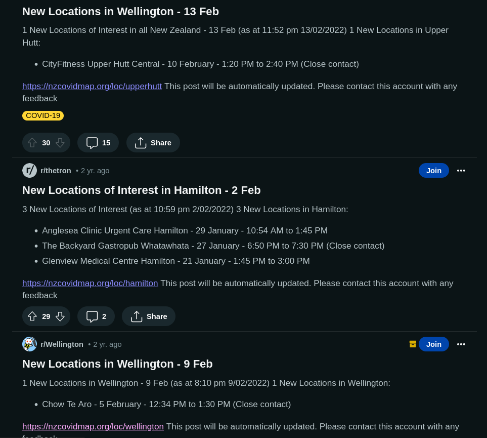
Each hour, the application would check for new locations in specific communities and (if a sub-reddit exists) posts for any new locations in a standard post format:
- Provide a Mobile-friendly view of Locations of Interest
- Raise awareness of Locations of Interests in our community.
- Lower anxiety for those seeking updates about their community.
Tech
- Up-to-date social Media sharing icons created for each town/city
- [Ingest] An n8n workflow that reads the CSV file published by the MoH. Locations are then categorized and saved in a sqllite db via n8n.
- An endpoint (also n8n) that returns all the locations in the last 30 days.
- A statically rendered Next.JS site that is published each hour. A mobile-friendly interactive map with all locations marked.
- A hourly job to build sub-reddit content and sent updates to places with new/updated Locations of Interest.
- Self-referential automatic meta image generation
Why so complex?
To reduce the complexity, cost and on-going maintenance cost of the application, i removed the n8n workflow the Next.JS site build on and replaced it with direct calls to the MoH API.
This allowed the site to be fully independent of my own local infrastructure and for its whole lifetime, run entirely for free on Vercel